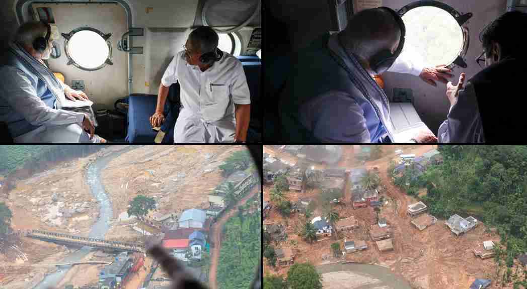
Prime Minister Narendra Modi conducted an aerial survey of Wayanad today to gain a detailed understanding of the landslide’s impact before visiting the disaster sites in person. This preliminary aerial inspection was critical in assessing the extent of the damage and coordinating relief efforts effectively.
The aerial survey allowed Modi to view the origin of the landslides, which began near the Iruvazhinji Puzha (River). From the air, he observed the severely affected regions of Punchirimattam, Mundakkai, and Chooralmala, providing a comprehensive perspective on the scale of the disaster.
Modi’s aerial inspection revealed the full scope of the destruction and facilitated a clearer understanding of the affected areas. The survey enabled the identification of key regions that need immediate attention and resources for recovery and aid.
“Today’s aerial survey has provided essential insights into the scale of the damage and the urgent needs of the affected areas,” Modi said. “The central government is fully committed to mobilizing resources and coordinating with state officials to support the recovery efforts in Wayanad.”
The aerial view not only highlighted the immediate areas of concern but also informed the subsequent on-ground visit planned by the Prime Minister. This visit will allow Modi to engage directly with local authorities and residents, further assessing the situation and reinforcing the central government’s commitment to relief and recovery.
In response to the aerial survey findings, the central government is expected to announce additional relief measures, including financial assistance, support for rebuilding infrastructure, and aid for displaced individuals. The survey’s insights will play a crucial role in shaping an effective response strategy and ensuring that resources are directed where they are most needed.
Prime Minister Modi’s approach, combining aerial reconnaissance with a physical visit, demonstrates a thorough commitment to addressing the disaster comprehensively. As recovery efforts ramp up, the information gained from both the aerial and on-ground assessments will be instrumental in guiding relief operations and supporting the people of Wayanad.


